(This blog entry is from my Patreon blog, where you can see my Adventure Blog entries before anywhere else while supporting my trade and craft. Along with early blog posts, Patreon backers also receive access to trail comics, drawings, and videos.)
Originally posted: August 14th, 2018
August 4th – Saturday -14.3 hiked – 263 total – m. 1969.5
Crap, this is my last lined page for over 100 miles. I guess after this I type my journals.
So we jumped up to Oregon, where we’re hiking the last 200 miles of the state to arrive just in time for Trail Days. First thing I noticed about the trail here is how smooth and level it is. We climbed 1000 feet in the first few miles and I didn’t even notice. There are also a lot of thru-hikers up here–we’re in the bubble/herd–which is a welcome change to the huge crowds of JMT hikers in the Sierra.
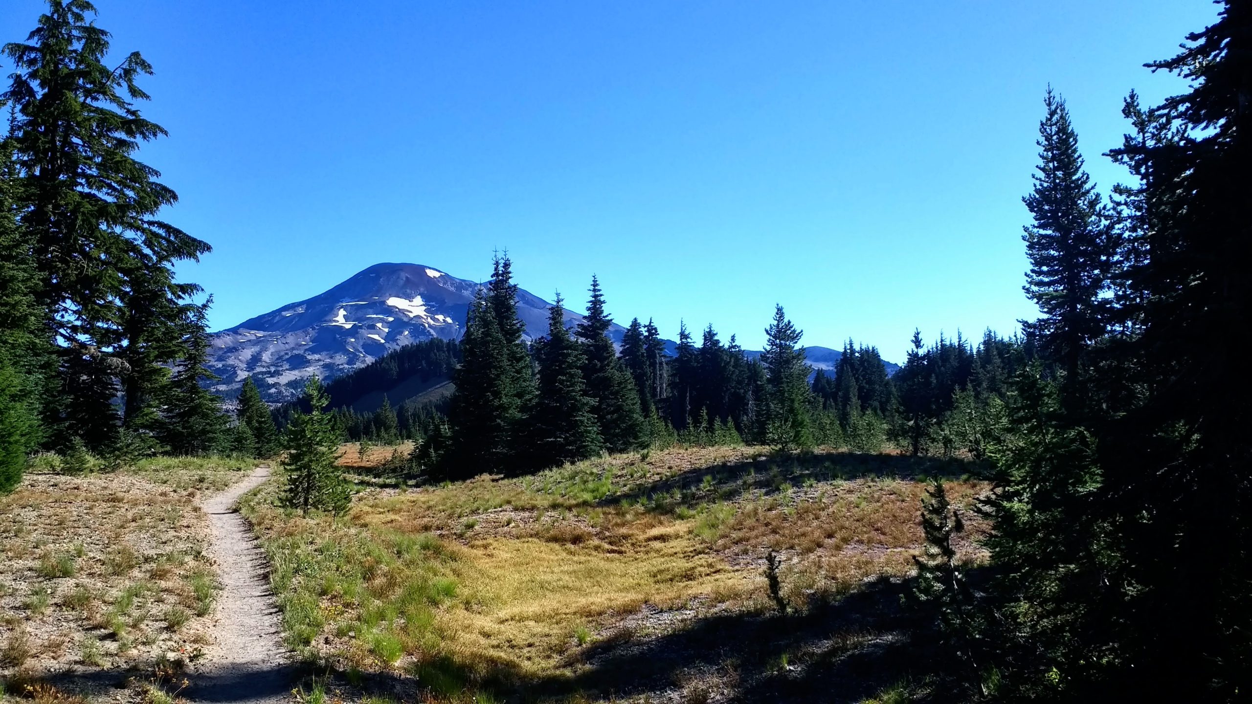
I’ve never hiked this section, it’s lovely. From the glacier carved Sierra to the volcanic fields of Oregon. I’ve been staring at volcanos all day. They’re so cool.
Uphills still kick my butt though, at least toward the end of the day. My legs still feel heavy and I don’t know why. Maybe I need to start taking my iron supplements again. Thankfully we’re in no rush. Trail Days is in two weeks and we have less than 200 miles of easy to moderate trail to hike. We can take it easy here and savor the trail.
August 5th – Sunday – 14.4 hiked – 277 total – m.1984.1
Day two of Oregon. Bones said he wanted to sleep in, but I didn’t hear what time he wanted to leave camp. So I slept for an additional hour and a half and then did my usual morning routine. Pee, organize food, prepare and drink my morning protein shake, reluctantly change from my warm sleeping clothes into my hiking clothes, and break camp.
Turns out he meant for us not to leave camp until 8. I was breaking camp at 7. Whoops. I normally wake up with 5:30 without an alarm so waking up at 6:30 was pretty dang late for me.
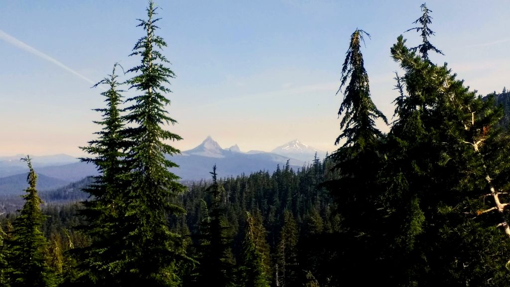
First thing after hiking out, we entered the Obsidian Limited Entry Area; an area that requires a specific permit. PCT hikers can hike through but not camp and must stay within 250’ feet of the trail. After a half mile on I could see why one would want to restrict traffic. There was volcanic glass EVERYWHERE. It glittered in the morning sun, and it was so hard to resist temptation and take a shard home. There’s even a waterfall that pours over huge obsidian rocks. It’s a magical place.
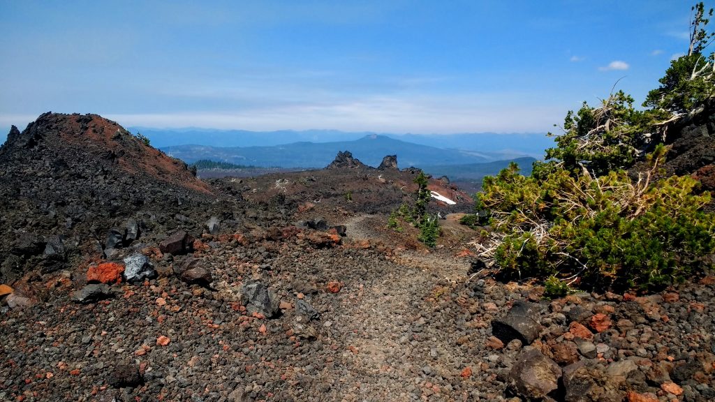
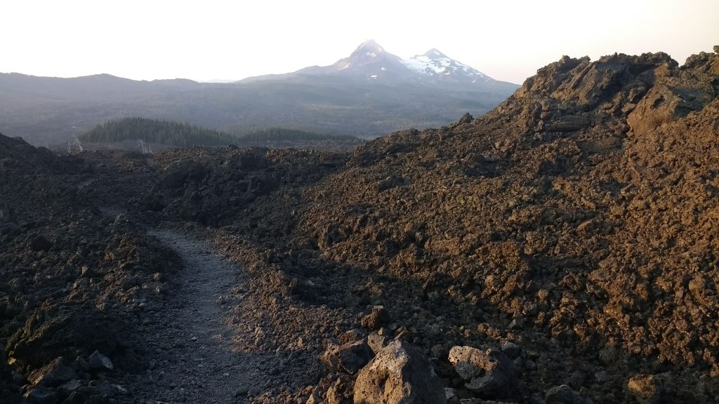
But really, Oregon is a violent place, which is strange since it’s sort of seen as a hippy utopia. Almost half of the state is high desert, which we saw from the ride into Bend. But the spine of the state is full of volcanoes and remains of volcanos long since past. We’re hiking around the Three Sisters mountains, which have huge fields of lava rocks spewing out from each side. They’re huge barren stretches of porous rock, not unlike the stones you use to exfoliate your feet. They’re hot, dry, and resemble an alien planet when stuck in the middle of one.
Throughout the day we passed in and out of these fields, stumbling and fumbling. I swear I’m going to break my trekking poles if they get stuck in a crevice one more time.
For the second day in a row, we took a long ‘lunch’ at a lake before hiking the last 3 or 4 miles to camp. I usually use this time to cook and eat my dinner meal so I don’t have to worry about it at camp. Nobody likes to do dishes in the dark. We’ve also been dry camping lately, which is when you camp in an area without water access. While a pain to calculate how much water you’ll need to pack in for that night and the following morning (and heavy!) you’re rewarded with fewer bugs, a quieter camp, and less condensation in your tent come morning.
Also, for the second day in a row, I had an avocado for dinner at camp. Since this was just a three day stretch before the next resupply we brought a lot of fresh fruits and vegetables. Snow peas, baby carrots, cherries, bananas, clementines, and avocados. Safeway had a lot of good prices when we visited haha. Amazingly they’ve kept cold and crisp in our bear cans. I want to do this more often, but this was our last grocery store stop for the entire trip. After this, it’s all mailed resupply.
Tomorrow we hike into Big Lake Youth Camp, where our box is waiting for us. They welcome PCT hikers and provide us with free showers, laundry, charging outlets, and wifi. But in between here and there are 11 miles, of which 4 is nothing but lava rocks. I plan to get up early-early and hike out before it gets too warm. I hike better in the cool morning air. Bones gets to sleep in like he prefers to, and will probably catch up to me before I get halfway. Either way, I hope to make it there before noon. We’ll see how this turns out.
August 6th – Monday – 12 hiked – 289 total – Big Lake Youth Camp
I did manage to get up real early. I resisted my alarm at first, at 5 am, but realizing I was accountable only to myself this morning, I stumbled out of my tent. I was packed up, fed, and ready to go in less than an hour. Sleepy Bones got a kiss and I slipped out of camp.
The sun was just barely over the horizon when I reached the lava fields, and the size of it left me in awe. Standing in the middle of it there was no end to the rolling black, porous stone. In the morning light, it had a red hue that gave it an eerie quality. It probably didn’t help that I’m listening to a new audiobook about post-apocalyptic America following all-out nuclear war. The hike through the lava was slow and quiet; it seemed to absorb sound. At the top of the main climb, I snacked on a protein bar and felt my stomach gurgle. Again? But I went before I broke camp? Luckily I was only a third of a mile to the end of the fields. I couldn’t imagine trying to dig a cat hole in this, let alone use it. It was not a standard delivery, my body told me.
Later, when I returned to the trail, fumbling with my pack straps, I felt sick. That wasn’t good. I thought about Bones coming up in an hour or more only to find me leaning over a tree, barfing up valuable calories. Oh please don’t be a stomach bug.
As I hiked on, the feeling went away. The forest was littered with blowdowns, and eventually, I found myself in another lava field, albeit a little overgrown. My skin was hot, so I applied sunscreen. But not without first dropping the small tube, leaving a smear of white cream on black rocks. Shortly after the rocks gave way to a shady patch of trees and a nice place for a break. It was 8:45 am, and I had hiked 4.5 miles. A bit slow, but the terrain made it acceptable. As I sat down I mused, “Bones is probably only just leaving camp right now”.
He then came around the bend, barely 3 minutes behind me. What the hell?
He apparently left around 7:15 am. I’ll forever be baffled by how fast and nimble he is, especially on terrain that leaves my ankles throbbing. One of these days I’ll blow him out of the water and reach camp hours before him. One day.
Everything’s a competition to me.
We hiked on, the sun getting hotter and the trail getting steeper. No longer in the lava fields, we hiked through bleached timber, lush with fireweed and tall grasses, scorched by a blaze in 2011. It was just as exposed as the lava, but the smoother terrain allowed me to speed up, therefore heating me up. We took another break around 10:30 am, about 3.6 miles out, not including the .8 mile side trail to BLYC. The trail continued being smooth, and my audiobook had me hyper-focused. Zoom Zoom.
We arrived at the trail junction in just an hour and finished the last .8 in another 12 minutes. Going fast feels so good.
BLYC is a 7th Day Adventist summer camp that welcomes pct hikers with open arms. We signed in and checked out their brand new welcome center, just for us. From some of the items in the building, we could tell some corporate sponsor helped them out, namely Subaru and Dutch Bros coffee. Everything was sleek and new. Lots of comfy but easy to clean chairs, a power outlet every 5 feet, a coffee pot with endless beans, and a community fridge. The washer and dryer, just for us, no quarters required, were very modern. Our packages were stored here with a do-it-yourself inventory system and there were two huge bathrooms with equally huge showers. I felt spoiled. Until I took my time-restricted 3-minute shower and discovered halfway there was no soap in the stall. But there was a jar of used coffee grounds with a note saying ‘good for exfoliation’. I washed with coffee, and it wasn’t half bad.
I did laundry, received my packages, figured out my stuff, and ate food. The camp fed us well, requesting only donations and insisting we ate as much as well liked. I donated $30 for both Bones and I. There are a lot of Southbound hikers here, and one of them, Peach, was a cool dude. We talked graphic novels and I told him how this camp reminded me of Vera Brosgol’s book Be Prepared, my recent favorite. Granted, this camp is much more modern than the Russian Orthodox summer camp Vera visited as a child.
I tried charging my electronics, but they were taking forever. Even after dinner, they weren’t finished. Probably too many hikers plugged into the building. Meanwhile, I savored the feeling of freshly washed clothing, dirt, and salt-free. Oregon is so dusty.
Due to capacity restraints, and probably privacy as well, hikers aren’t allowed to camp on the grounds of BLYC. But we can follow a trail around the lake and camp anywhere we like. So at sunset, we did just that, finding a private cove just to ourselves. We set up our tents, our freshly showered feet already caked with dust from the short walk, THROUGH our shoes, and went to bed to the sound of late night boaters.
August 7th – Tuesday – 8.8 hiked – 299 total – m. 2004.9
Today was a very sleepy day. I woke up sleepy, hiked sleepy, ate sleepy, and couldn’t nap.
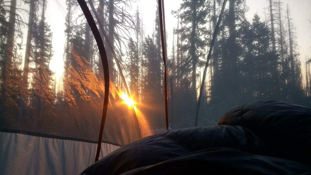
We got up and went to join the everyone for breakfast after breaking down camp. I plugged in my battery and phone to charge in the meantime and hoped for the best. The camp served us a variety of scrambled eggs and hash browns–I’m still floored at the generosity of these people. Bones wanted to leave asap, he had a bad experience here last year and didn’t want to stay. I was being stubborn and didn’t see what the problem was. This place was great. Plus my stuff wasn’t charged yet. We Jae a 6-day stretch coming up with no outlets until Timberline.
So I dragged my feet a bit, doing chores at the last minute, and doing little things as I remembered them. Of course I wanted to get back on the trail, so we did, eventually.
We hiked out around 9:45 am with a lofty goal of 11 miles. Not bad. But the day was already turning out to be a warm one, and there was no water until mile 14 from BLYC, so we carried some extra liters.
And I was still very tired. What the hell, man? At every break we took my eyes were heavy and I nearly fell asleep. But I’ve never been able to nap, so of course, I couldn’t actually rest. A tracker app on my phone informed me that I am less than a week out from my period. Oh. That’s probably it. Probably why I’ve been feeling especially emotional today as well. Which didn’t help my situation.
At our second long break in an hour, Bones admitted he wanted to hike separately for a while. We’ve mostly been hiking according to my needs for the last 300 miles–slowly and lazily. We’ve been making milage goals, but not how he wanted. I haven’t been able to give much room for compromise either, as I’m quickly pushed to my limits when trying to match his hiking style. We’ve known for a long time that we are completely different hikers. I am the tortoise and he is the hare. And it’s not fair to constantly hold him back.
I, emotionally, agree with splitting, as I’ve been getting frustrated with his impatience and snide comments lately (probably because of hormones). I think it’s best that I sort my shit out in solitude than drag him down with me without figuring much out. It’s 4 pm, we’ve hiked 6 miles so far, and he heads out on his own. We agreed to meet up at Olallie in 45 miles.
While hurt, I’m washed with a sense of relief as he leaves. I get to set my own pace, determine my own breaks, and make my own decisions. Solo hiking. A new experience.
But I’m still exhausted and I really hope I feel better tomorrow. Not long after he’s left I pack up and go too. But I don’t see him again, he’s too dang fast.
Before I leave I check my phone, which still has service, and I see this area has a heat advisory for the next few days. Upper 90s to 100s. Awesome. Great.
I don’t get very far in the afternoon heat. All day the trail has wiggled through a huge, exposed burn area. I’m drenched in sweat and want nothing more than to sit down. I’m rationing water too, because I know I won’t be getting to that water source today. It’s too dang hot. I hike another 3 ish miles before I find a decent tent site. I call it quits here.
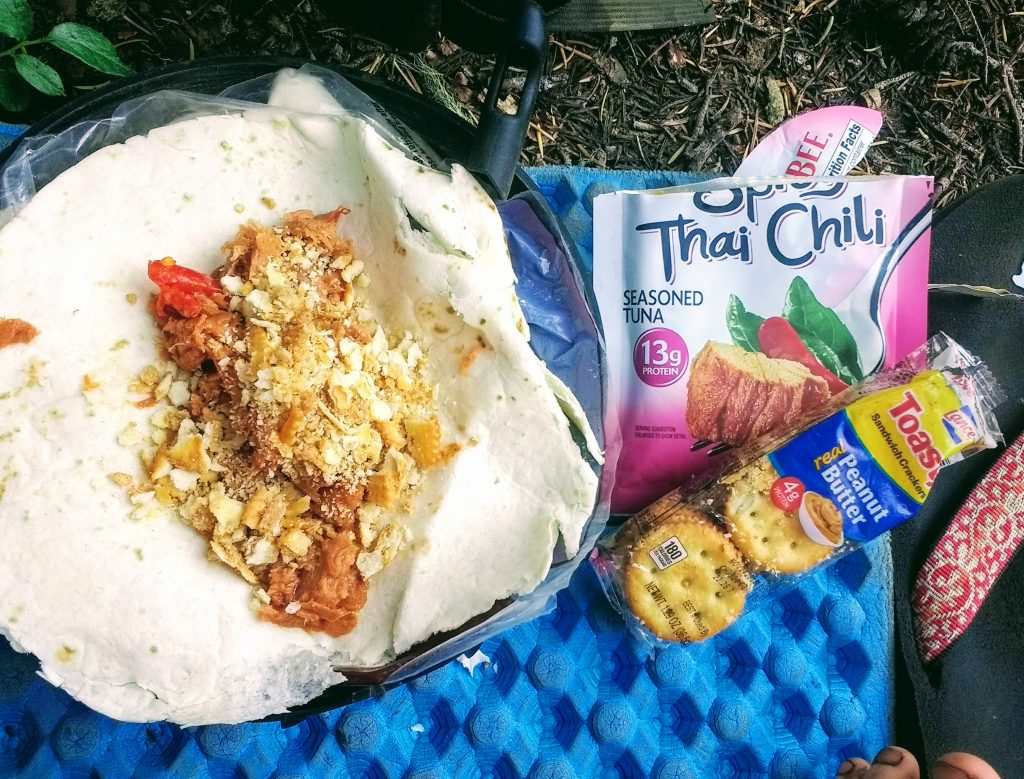
I eat some spicy tuna on a tortilla with some crushed peanut butter crackers and toasted sesame oil on op, and clean myself of dirt with some baby wipes. I listen to my audiobook for a little longer, but then lay in my tent staring at the trees.
I’m bored.
It’s only 6 o’clock. I could have hiked farther. No, I’m too tired. But if I fall asleep now I’ll be up too early, and then I’ll be REALLY bored. I definitely could have hiked farther. Packing up my tent and stuff would take too long so I may as well stay.
I sure am weak. I don’t belong out here. No, I just having a low day. This happens. Not every day is going to be a gold medal day.
In a fit of stubbornness, I plan out the next two days to Olallie. I’ll get up early to beat the heat, I’ll get there with time to spare. I’m not weak, and I’m not a bad hiker. I just have my own style of hiking. As tragic as it is that Bones and I don’t hike the same, we don’t always have to be a team. Sometimes we can be our own team.
August 8th – Wednesday – 18.9 hiked – 318 total – m. 2023.5
I awoke in the early morning, before first light, and immediately noticed how warm I was. I threw the covers off, sweaty, and felt my forehead. No, I’m not feverish. But I feel like crap anyways. My water is warm too. Usually, it cools off overnight. Shit. If it’s this hot already at 5am how hot is it going to be during the day?
It’s quiet. No one else joined me in this tent site last night, and it’s strange to be so alone. But a few minutes later a thru hiker passes on the trail, headlamp blazing. I have breakfast, pack up, and hit the trail within an hour. Not before leaving my daily deposit, however, and I’m concerned again I may have caught a bug.
The trail goes uphill to go around Three Fingered Jack. I know this area, kind of. We hiked here two years ago on my first ‘long’ backpacking trip. Now I’m here again, going solo for the first time. I wonder about Bones. How far did he go last night? Did he too also only go a few miles? As I pass tent sites, I look for his tent as he tends to sleep in. When I don’t see his bright green Nemo, I search the trail for evidence of his foot prints. I’m like a tracker. He wears Sauconys, a relatively uncommon trail runner out here. The tread is unique and in soft sand, you can clearly see the brand name imprinted in reverse. But I find no evidence of his steps. The sun rises, bright red in the still smoky skies. I’ve started the habit of hitting my inhaler before I even leave camp, and it seems to help. I pass an area where I remember nearly having an asthma attack last time, before I knew it was asthma. I’m not cruising, but I’m not doing that bad either.

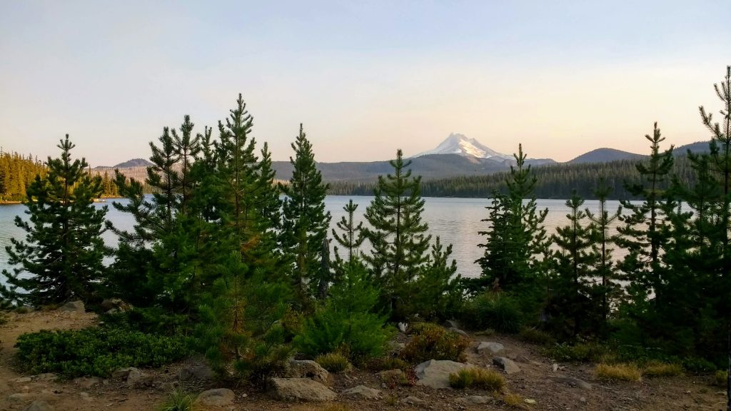
I crest the ridge of Jack, disappointed that Mt. Jefferson is obscured by smoke. It’s all downhill from here to water, and I’ve got a liter and a half left. On my way I pass two deer that obviously don’t care about humans; no wonder hunters come here in the fall. It’s easy pickings.
The pond is how I remembered it, although missing from it is the deer that charged us, and the awful hummus we ate for lunch. I eat a protein bar and a baggie of fruit gummies, and consider my water situation. The next source is Rockpile Lake in 4.5 miles. There’s still got a liter left in my pack. I leave the pond without getting water, and the trail immediately starts going uphill again.
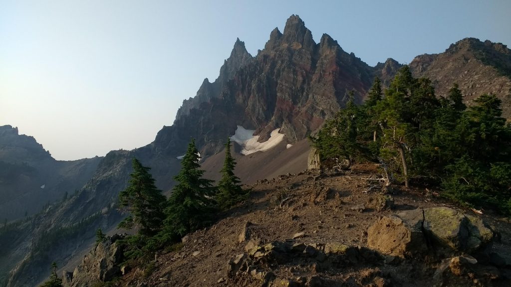
A mile in I’m confronted with a sign. The next 0.8 miles are new trail laid out to address erosion after the wildfire that ripped through here a few years ago. I do some math, and realize this adds a third of a mile to the trail. If the area wasn’t so exposed I’d be happy for bonus miles. But this area sucks.
Regardless of the extra milage and the heat, I make it to Rockpile Lake in 2 hours, as estimated. It felt like forever though, that last ridge walk seeming shorter in my memory. Not another soul around, I have the lake to myself. I strip down to my underwear and go for that lake swim I’ve wanted all summer.
It’s not as I expected it. The lake bottom is a thick muck and it sucks my down to my ankles, stepping on the hidden rocks underneath. I trip and stumble, but make it to the middle where the ground is a bit firmer. The lake is only waist deep, but I paddle around a bit, enjoying the weightless sensation on my poor knees. I’m startled by a fat salamander on the bottom. I guess I’m intruding, aren’t I? Tripping and stumbling some more, I retreat to the shore for lunch.
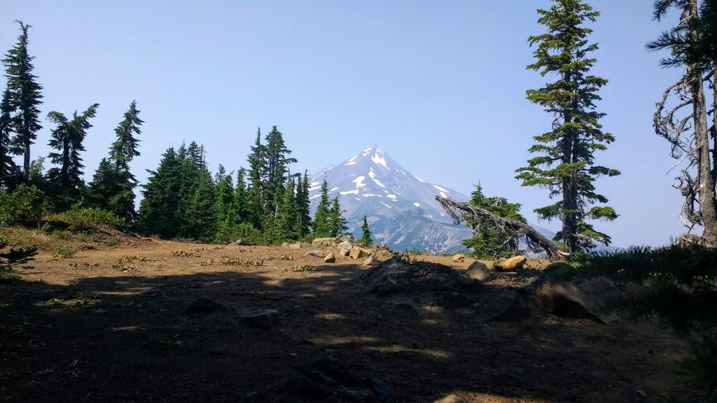
Two hours and a lot of food later, when some other hikers have shown up for their own lunches, I pack up and leave. Last time we here here, we hiked out in the early morning and he following two miles were obscured by fog and wind. In a stark contrast, I finally see the area for what it is. More exposed burn area, and hot too. I consider turning back and returning to the lake until it’s cooler, but I push on through. 8 miles to the NEXT water source, and less than a mile after that to camp for the day. I’m going to have a 19 mile day, gotta make up for yesterday. Thankfully that climb up to Rockpile Lake was the last big climb for the day, and it there are still lots of smaller climbs along the following ridges. I’m much closer to Jeff now, and it’s not so obscured by smoke anymore. Hello old friend.
Every hour I find a spot in the shade to hide from the sun for a while, until I’m cooled off and calm again. Each time I manage to find a spot with a great view of the mountain. On one of these stops, I wrap my left pinky toe in paper tape. It’s started to rub painfully, but it isn’t blistering.
At some point, while hiking, I’m passed by a southward bound group of backpacking teens. One of them kindly requests if they can ask me a question. They ask how much it costs to thru hike the PCT. I respond that I wish I knew, as I’ve never done it before. But I’ve seen estimates of one thousand a month, not including the wages lost from the job you don’t have in those five to six months unemployed. He thanks me, and catches up with his friends.
As I get closer to camp, I’m contemplate going farther. There’s another tent site just 4 miles farther, and it’s all downhill. Easy, right? I juggle the idea back and forth. If I go farther, tomorrow will be shorter. But if I’m more sore tomorrow from today, I will be harder anyway. Ultimately I decide against it and head to my originally intended tent site. My feet hurt something awful, my daily painkillers wearing off an hour ago or so. It’s 5:30 when I arrive at camp, and as I’m setting up I curse myself again. This is too early. I still have hours before dark.
Before splitting yesterday, Bones and I agreed to message each other with our Garmin InReaches each night to keep informed of our daily mileage. I send him mine, feeling proud of my 19 miles. 2 hours later, when he finally stopped I guess, he responds with his.
That asshole is 20 me ahead of me. What the actual fuck? How is that even possible? How late did he hike last night?? Blarg. Whatever. Now he has to spend a whole day waiting for me to catch up at Olallie. Not my fault. I’ll probably only go 15 tomorrow, since I’ll be passing through the relatively difficult Jefferson Wilderness Area. I’m okay with that.
I’m not alone in camp tonight. Two hikers come in while I’m eating dinner, and them a family comes in just before bed. This tent site is on the edge of a No Camping zone, so it makes sense. I hope tomorrow goes as well as today, if not better.
August 9th – Thursday – 19.7 hiked – 338 total
That night I dreamed my legs were rotting. They had the appearance of sponges with oversized holes, or Swiss cheese, but brown and slimy. I could still walk just fine for the most part, but I knew sooner or later I’d be down to the bone.
My watch beeped at me. 5am. I held my hand up to check the light. Nope, can’t make it out. Too dark to get up. I rolled over.
Someone coughed and it was suddenly much brighter out now. Okay, I guess I’ll get up.
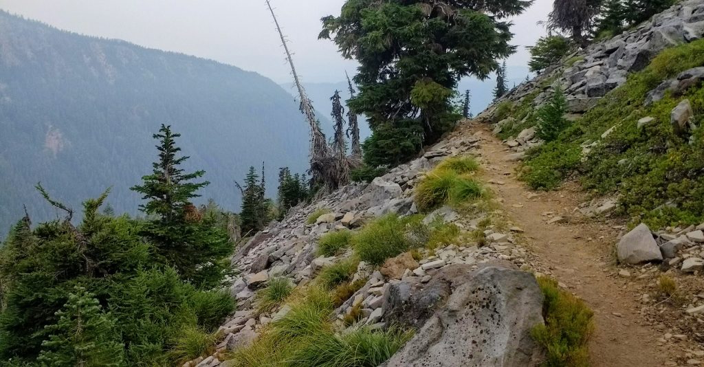
For the second day in a row, my bowel movement has me concerned. Did I eat something bad? Did some unfiltered water make it into my supply? This is getting frustrating. As I pack up, I’m being overwhelmed by mosquitoes. Despite their onslaught, I keep a level head. No need to get bent out of shape because of a few (hundred) bugs. It’s 6:30 when I finally hit the trail.
It’s all downhill for four and a half miles to Milk Creek. It takes me a standard hour and a half to get there, but before I quite make it I have to yet again talk to a man about a cat hole. What the hell, man? I’m hoping this is the last of my bowel troubles because I only have so many baby wipes. I get down to the creek, cross, wash yesterday’s socks, and inhale 500 calories in the form of a ProBar and a packet of peanut butter. It’s all uphill for the next 8 miles, 2500 feet.

First thing I notice in the climb is evidence of the Whitewater Fire that was burning this time last year. But it’s not too bad; the tree stumps are scorched, sure, but it looks like all the debris of the forset floor has been burnt up. That’s healthy. I keep climbing. A while later, as I turn a bend and approach the junction for Woodpecker Ridge, I’m suddenly in something that only resembles a forest if you were to drop some bomb on it. The black corpses of trees are burnt to the core, somehow still standing on a fraction of their original support. The ones still standing, anyhow. The others lay this way and that, ebony sticks on an orange carpet of dead pine needles. The ground is bare, no small patches of grasses holding their ground, no fireweed. The fire killed the soil. This was not a healthy fire. This was an ecological disaster.
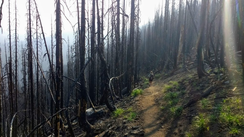
The tent site we stayed at last time is a shell of its former self. I wouldn’t even recognize it were it not for the trail leading up to it. The air is still thick with smoke, drifting south from the fire in The Dalles. But it gives the impression that this fire could have been burning as recent as this morning. I remember that the trail out of this tent site was overgrown and a green tunnel. It’s now an expanse of black and orange. The burn area apparently ends just after Russell Creek. I do my best to hurry there and out of this graveyard, but the steep climb has me cussing and bitching.
For the last month, there’s been rumors in the Guthooks comments (the map app used by PCT hikers that allows for crowd sourced trail conditions) about a dead horse in Russell Creek. There have been jokes and offhand remarks, and for a while, we thought it had been removed. I pass a sign from the NFS warning about a carcass in the area and to be aware of your surroundings due to increased animal activity. Guess it’s still there after all. It’s become a tourist attraction, strangely enough. Everybody wants to be the one to say “I saw the dead horse that was led to water and didn’t drink”. But when I finally get to the creek and see it with my own two eyes, it’s no longer a joke.
Granted, it blends in with the rocks pretty well. If you didn’t know what it was, and kept your distance, you’d probably think it was a rock. But I knew what to look for, and I kept as far away as possible. I couldn’t even look at it for more than a few seconds. It wasn’t even gross looking, only the rear and a little bit of the tail was exposed above the water, and it was very white and bloated, with greenish ‘moss’ patches. Just knowing WHAT it was horrified me. I wanted to throw up.
Thankfully I was forced upstream to cross the formidable Russell Creek, which turned out to be a tougher crossing that most of the creeks I tackled in the Sierra Nevada. I went up, scrambling in huge boulders as I went, trying it to find the right combination of rock placement and water flow. When I couldn’t find it, I went back down a little. But when the carcass came back into view I swallowed my fear and crossed at the first feasible place. The water was roaring so loud, and I wished desperately I was crossing with someone else. My heart might have been pounding in my ears, but I couldn’t hear over the water. On the other side, my shoes were wet and I was gasping for breath. I wanted to be as far away from that horse as possible. There was another rock scramble in between me and the trail, and I tripped and stumbled the whole way there. My plan was to take a break here and get water and half a snack. Fuck that plan. The trail was steep but I managed to get a tenth of a mile away and the sound of the creek faded and I found a place to rest.
Sitting in what may have been a fragile burned out tree stump, I chugged a whole liter of water. There are multiple streams in the next mile, so I push myself a little past my limits for the sake of my sanity. I hike just under a mile, and take lunch at Whitewater creek, a gentle thing with a small footbridge. I make a mental note to ask the PCTA about installing a bridge at Russell Creek. It’s no wonder the damn horse died.
True to its name, Whitewater creek has a cloudy appearance. Glacier silt, I assume, and I hope it doesn’t gut my filter. I have hot noodles in thick mashed potatoes, drink a few liters, and pack up by 12:45, same as yesterday.
As I’m about to leave, a trail maintenance crew passes going south. I manage to catch the last one and ask what project their doing. Turns out they’re Phase 1 of the Jefferson Park trail renewal project; I’m signed up for Phase 3 at the end of September. He gives me a rough idea of what I’ll be doing, and where; rock shoveling and root cutting, just before the ridge. What luck this was.
There are 3 miles of serious climbing left today, and they’re all in front of me. Once I get over the hot and exposed ridge I’ll be out of Jefferson Park, and have gentle rolling hills for the next 50 miles. But these 3 miles need to be beaten first.
It’s hot, of course. Clearly, that heat advisory is still in effect. A young lady hiking south stops me and asks if I’ve seen a dude in a hat. Baffled, I reply that every dude out here is wearing a hat. She says thanks and keep walking. What just happened?
An hour and a half later I make it to the top, sweaty and exhausted. But the view is underwhelming, as it’s filled with smoke. Usually, you can see all the way to Mt Rainer, today you can only see the first butte, maybe a mile away. However, much to my delight, there is a big snow field waiting for me on the other side. The rocky terrain tried to trip me up, but I’m determined to get my hands on that snow. I do, and input two fistfuls under m hat and another two down my shirt. The cold bites at me but it’s so refreshing. A little farther down the trail, the trail crosses some snow with a downward angle. Halfway across, mid shuffle, I ask myself what the hell am I doing. So I sit on my butt, and half-shimmy half-sled down the snow, giggling the whole way. I didn’t get to glissade in the Sierra, so this is way overdue.
Soon though, my Garmin chirps that I have a message or three. I hike a bit longer, until I can sit in some shade, and check my mail. It’s Bones. He’s reached Olallie and is frustrated that they are now cash only, blaming their lack of rustic lack of electricity. When we’re there a few years ago they took cards and ran the info in a weekly fashion. Not anymore, I guess. I don’t have any cash. There goes any possibly of chips or soda, let alone a cabin. I let him know how far out I am and my plans for the day. I may try and go all the way to Olallie, but my feet are hurting so probably not. That would be more than 20 miles for the day.
At this point, the trail is starting to ‘level off’, but is filled with rocks. I thought my memory had told me that the trail was worse than it actually is. Nope. My memory was accurate and this section of trail is actually pretty painful. The tape isn’t staying on my feet anymore, so I have no protection against hot spots. And the pads of my feet ache, sore from flecks or dirt being ground into my callouses. I’ve started to regret putting the snow down my shirt as well, since now he front of my ski and shorts are damp, and are beginning to rub that soft area where m legs and crotch meet. Hope this doesn’t get much worse. But otherwise, I’m not doing that bad. Usually, this far into the day my pack straps are making my shoulders throb and I’m several levels of exhausted. But I guess I’m just one or two levels of exhausted. So I keep hiking.
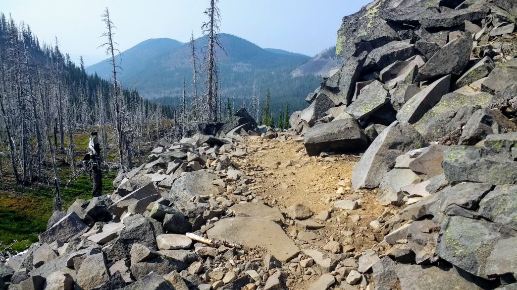
It’s just about 6 and I know I’m coming up on Upper Lake, which makes 2.5 miles to Olallie. I can make that. It’ll be late but I can do that. So I set my goal and I’m heading to the resort. First I slow down and take a few reference photos of the lake for BASHers, and I see a figure with a blue shirt stepping out of a bright green tent that blended in to the surrounding foliage. It’s Bones.
Apparently, in his frustration with the resort and some rude day hikers, he came back to Upper Lake, a special place for us, and crossed his fingers that I’d make it this far today. He wasn’t banking on it though, so I was a pleasant surprise. I was also grateful that I didn’t have to hike those last 2.5 miles, because my feet were screaming. But as I make myself at home, and my body cools and dries off from hiking, I realize I’ve developed a nasty, swollen chafe between my legs. Oh fuck. I walk like a cowboy to prevent additional rubbing, and curse myself for not having any baby powder. Shit.
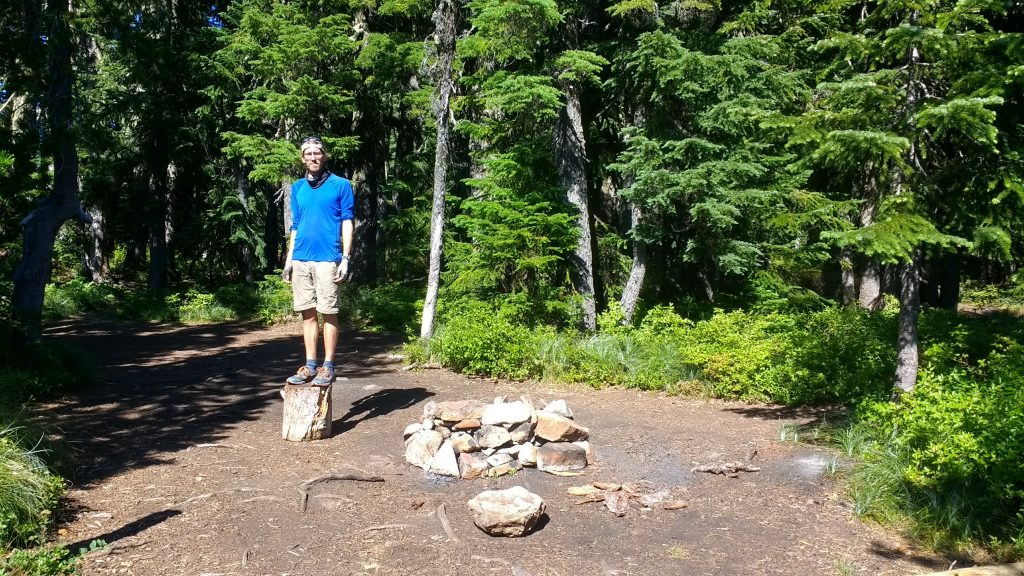
Bones had a zero day yesterday, and I’m hoping I get one tomorrow. I haven’t had a day off in over a week, and I think I’ll need it to get this chafe to chill out. Now I only wish I had cash on me to get some munchies at the Olallie Store.
August 10th – Friday – 2.5 hiked – 340 total
I wake up and it’s surprisingly bright out. My watch says 6:50am. Wow. Dang. Late. Good thing I’m not going anywhere today. I crawl out of my tent with my sleeping quilt and squeeze onto Bones’ tent for some cuddles.
A while later I have breakfast, cold oatmeal and warm instant cappuccino. I think I like oatmeal better when cold.
The rest of the day is kind of a blur. I developed a headache shortly after breakfast and it hung on late into the evening. I know we hung around camp, I napped, washed my clothes. Bones and I discussed possible plan changing because it appears that I’m developing some eczema on my ankles. Hopefully, that doesn’t advance like last year, but I need to be prepared. I started my period. Oy. Glad I have supplies this time around.
We packed up and left around 4, just to get to Olallie, buy a single soda, check out the hiker box, and camp nearby. But when we get to Olallie we discover that some Trail Angels, Trash Panda and Broke Leg, have set up shop and are serving dinner and drinks. Headache or not, I indulge in a hard cider and some spaghetti. But eventually the crowd is too loud and I have to retreat to the lakefront. Sure wish this headache would go the fuck away. I can’t think straight.
Just as it started to go away, Bones suggested heading out to find a tent site. It was getting late, and cold. Before we left I asked if I could pack out an extra drink for the trail. Tonight turned out to be the last night they were doing trail magic for the year so the stock was fair game. I grabbed a large can of grapefruit soda beer and as I walked away I noticed a cookie box with a note on it.
“…Are those what I think they are?”
Those were the best damn rice krispies I’ve ever had, and I knew I was going to sleep like a baby tonight.
We walked a whole 0.1 miles and set up camp next to a beefed up fire pit with a dented smoke stack set precariously on top. Shame there’s a fire ban right now. We split the beer, and went to bed. I’ll be getting up early again and leaving on my own, and Bones will sleep on. He hikes way faster than me regardless of trail conditions and I hike faster in the morning when it’s cool. We plan to do a 20 mile day tomorrow, like we did last time. I need to get a good head start.
